Discover the Gours du Ray canyon, a small, wild descent located in the Loup Valley, just above the village of Gréolières.
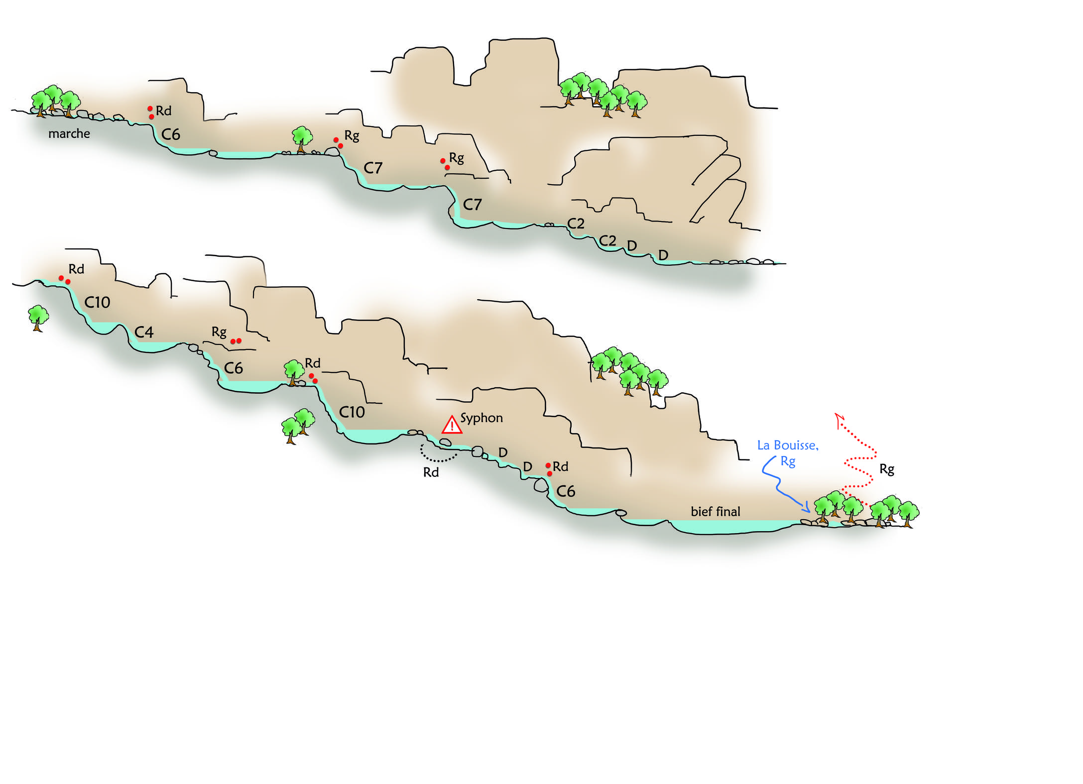
This canyon is characterised by a series of basins carved into the limestone, known as "gours," which give the site its name. The progression alternates between small abseils, easy down-climbing, and aquatic passages within a preserved natural environment typical of the Grasse Prealps.
Relatively short, this canyon is a delightful outing for discovering canyoning in a calm and wild setting in the Nice hinterland.
Country : France
Region : Provence-Alpes-Côte d’Azur
Department : Alpes-Maritimes
Municipality : Gréolières
Massive : Préalpes de Grasse
Basin : Loup
Watercourse : The Loup
Start Altitude : 700 m
Vertical Drop : 69 m
Length : 700 m
Maximum Waterfall : 10 m
Technical Grade : V2A3I
Minimum Rope : 20 m minimum
Approach : 15 min
Descent Duration : 2h
Return : 30 min
Shuttle : Not required
From the car park, follow a forest track that descends gradually towards the valley floor. After a sharp left-hand bend, leave the track and take a small, steep path on the right to reach the watercourse.
The approach walk takes about fifteen minutes and passes through a forest environment typical of the Préalpes de Grasse.
The Gours du Ray canyon offers a fun progression through a limestone valley sculpted by erosion.
The route includes several obstacles :
Small drops
Easy down-climbing
Short abseils
Natural basins carved into the rock
The characteristic “gours” of the site provide beautiful aquatic sections.
Short and accessible canyon.
Obstacles are generally low in height, making it perfectly suited for children.
Ideal route for a relaxed canyoning trip in the Loup Valley.
Wild and uncrowded environment.
At the exit of the canyon, follow the path that climbs up the left bank to reach an old aqueduct. Cross it and continue on level ground for a few hundred more metres to rejoin the forest track used for access.
The return journey takes about 30 minutes of walking to get back to the car park.
From June to September!
Check hydrological conditions before setting off.
Check the depth of basins before every jump.
Use full canyoning equipment (wetsuit, helmet, and harness).
Respect the natural environment and preserve this discreet site in the Loup Valley.